Recording on the Apostle Islands
In August 2016, 2nd Lieutenant Erik Doering and I were contracted by a former professor, Christopher Plummer, to plan and execute recording trips to Isle Royale National Park and the Apostle Islands National Lakeshore as part of a NEA/NPS Imagine Your Parks Grant. The grant project, “Listening to Parks”, hopes to inspire people to visit and be conscious of the sounds within these parks. In 2022, recordings from this project were featured in the American Pavilion at the 2022 United Nations Climate Change Conference (COP27).
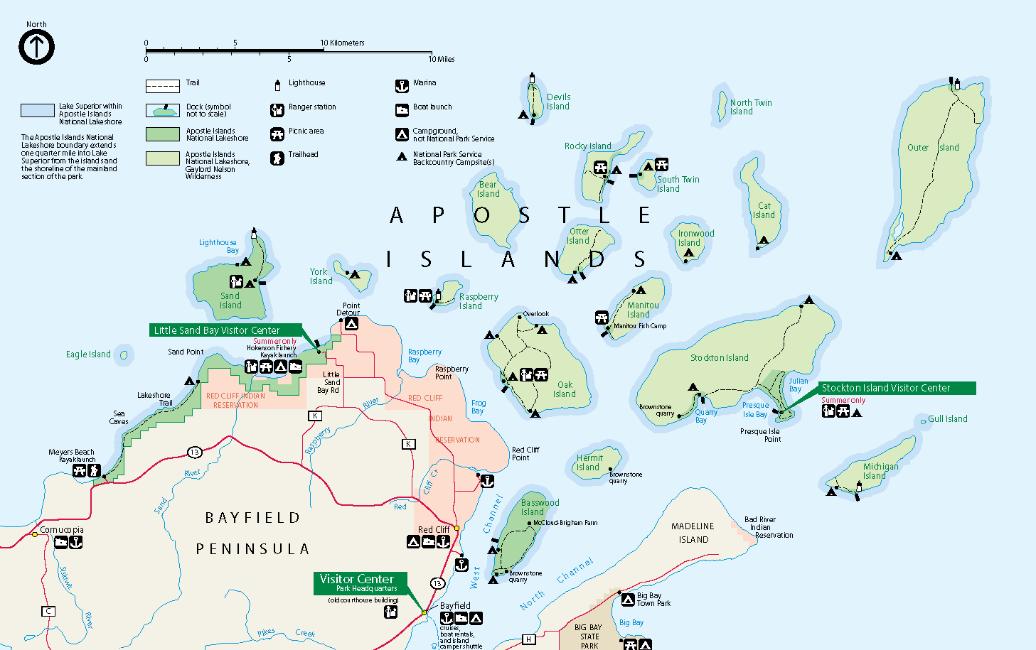
The Apostle Island National Lakeshore are a series of 21 islands and 12 miles of shoreline near Bayfield, Wisconsin along the shores of Lake Superior, with a 10-year average of 187,000 visitors annually. One of the biggest attractions of the Apostle Islands are their natural sea caves, which turn into gorgeous ice caves in the winter. Our goal was to record those caves. Navigating into and through them is only possible by sea kayak.

Apostle Island Sea Caves (with me for size reference)
Day 1: Thunderstorm on the Lake
Our trip to the Apostle Islands was a quick 3-day trek through several islands that immediately followed our 5-day trek on Isle Royale. Thankfully, we were spared from having to carry all of our equipment on our backs for this leg of the trip, unlike on Isle Royale. Instead, we had to manage fitting everything within our kayaks.
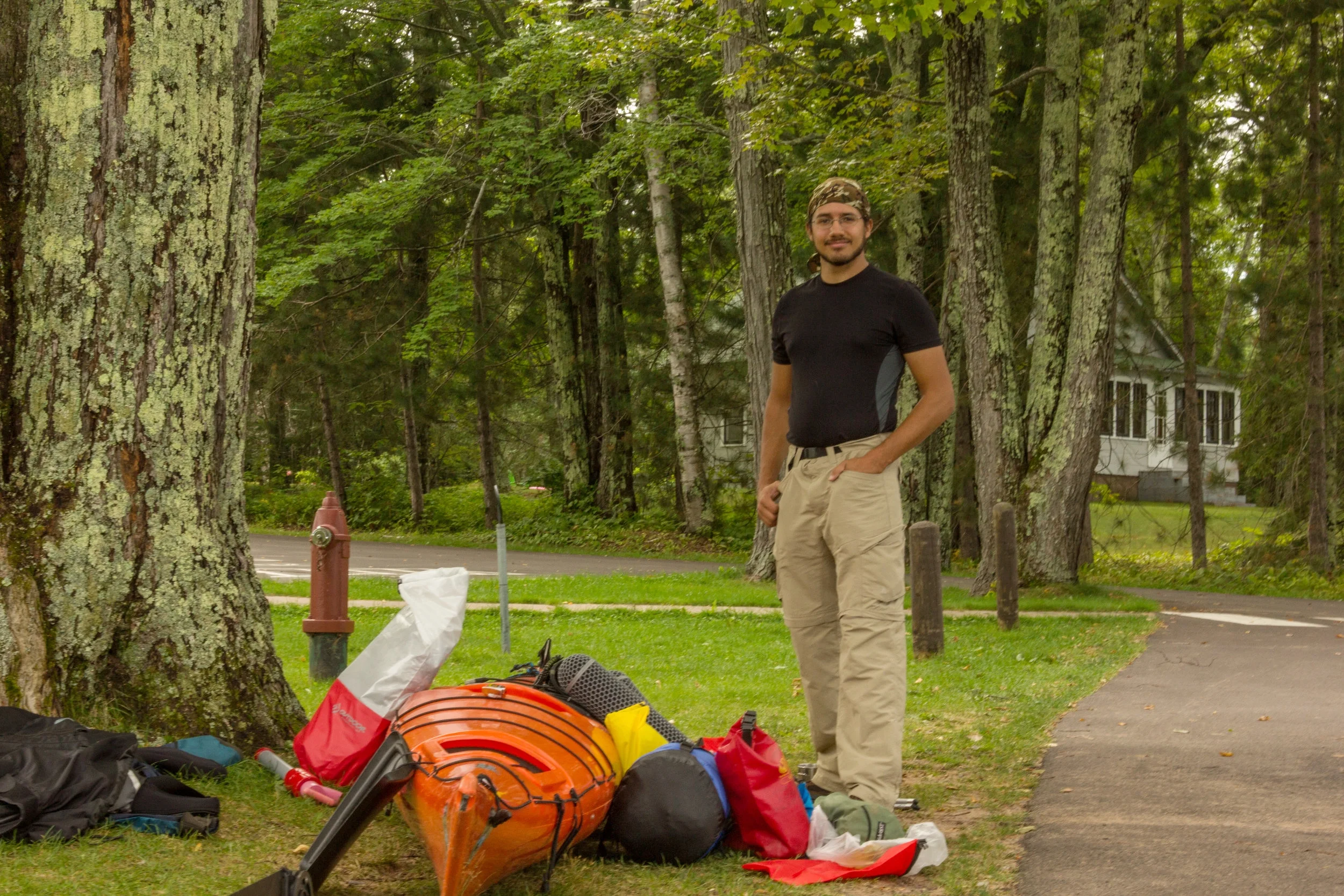
Loading my kayak for the trip
If you’ve never kayaked before, you may think that it’s a quiet serene form of transportation. On small inland lakes and lazy rivers, that can be true. That’s far from what it was for us. Lake Superior is by no means lazy nor is it small. Erik and I both have experience kayaking but this was our first trip with sea kayaks on the big lake. Early on we started experiencing excruciating lower back pain while we were paddling, likely from poor form. We regularly had to stop paddling to rest our backs. Gradually we fine-tuned our backrests, which offered a slight respite, but the going was still painful.

Beach the 1st night
Our plan was to spend our first night at the Apostles on an isolated shoreline campground, 5.5 miles away from our launching point at Sand Bay. From there we originally planned to strike out to the sea caves west of us in the same day and then make our way over to Sand Island on Day 2 to record the formations there. When we arrived, though, we were still in such pain that I knew we needed a prolonged rest if we were going to safely keep the expedition going. I made the call for us to set up camp and record the sound of the beach for a while to let our backs rest.
By the time we were feeling well enough, it was starting to get dark. Our weather radio also warned of a thunderstorm rolling in. We decided to stay safe and skip the shoreline caves. Instead we recorded the thunderstorm and turned in early.
Day 2: Challenges of Recording from Water
On the next morning, Lake Superior was gracious and gave us calm weather to proceed to Sand Island. En Route to our campsite, we stopped at the first cave formation. We investigated the formation and decided to beach our kayaks on a rock outcropping to wade over to some of the caves and record “on foot.”

Wading between caves

Wading in to record
To capture pristine nature recordings, I need to keep my microphone still and avoid making any sound. When recording quiet sounds, my microphones will pick up even the slightest shifting of fabric or forced breath. Using a tripod is usually the easiest way to record nature, as it keeps the mic in one spot and allows me to walk away. This wasn’t an option here, though. For this project I had to stand absolutely still for 5-10 minutes at a time. On land, this is no easy feat. Arms fatigue, mosquitos try to bite you, you get an uncomfortable itch. It’s even harder when you're chest deep in water, where you also need to contend with the waves swaying you back and forth, water lapping up against you, and keeping your equipment dry.

Investigating caves to record
After spending an hour or so at these first cursory sites, we boarded our kayaks again and investigated the deeper caves we couldn’t wade over to. In calm weather, you can safely go through many of the caves. Every cave gurgles and belches differently. Some have deep guttural sounds, like a giant rock thrown into water, while others are far more musical, with complex pitches and rhythms.

Anchoring myself to a wall to record
Eventually, Erik and I split up to record separately. I found sturdy handholds on the sides of the caves to anchor myself to record from my kayak. Silently keeping a kayak still, even in relatively calm water, is difficult. The current constantly tries to drag you somewhere. With one hand, I clung to the cave wall to anchor the kayak from hitting the wall or moving too far away. My other hand steadied the microphone and attempted to compensate for the water drifting me around. If the microphone shifts around too much, it creates a poor recording. I engaged in this strange acrobatic act for 5 minute increments, constantly checking the time tick away on my recorder. It was exhausting. After every recording, I lurched out of the cave to sprawl out and rest my weary arms and core.
Day 3: High Wave Adventure

Inclement Weather
On our final day, our good fortune with a well-tempered Lake Superior soured, and we awoke to heavy waves battering the shoreline. We knew it was a possibility but we both had secretly hoped that the weather would pass. So much for recording more caves before we left.
Although I had flexibility in extending our trip, Erik needed to get back to wrap up things before going on assignment with the US Army. Since we were in a lake-facing cove, we thought that we’d try to strike out around the point to see if we could quickly make it to the more sheltered part of the island.
The waves in the cove were a bit choppy, but manageable. As soon as we left the shelter of the cove, the waves got heavier than we were comfortable trying to traverse. We quickly turned around. Once we got back to shore, we started waiting (and I started recording). One hour passed. Then another. Erik grew restless.

Map of Sand Island (from National Parks Traveler)
If you look at a map of Sand Island, you’ll note that there is a trail going from the north side to the south side. We stayed at a new site in Justice Bay. The southern shore was about ¾ mile away along this wooded trail. Half-jokingly, I suggested to Erik that we portage all of our equipment to the south shore in the hopes that it would be better down there and, if it wasn’t, that it would at least shorten our return trip once the weather settled. Now, mind you, this was a joke in my mind because prior to this point I had never carried a kayak more than the several hundred feet from a car to the shoreline. Erik stopped a moment, considered it, and very quickly agreed with me that portaging would be the best course of action. Better to move and be making some progress than wait and be restless.

Beginning to Portage Gear
We unloaded our gear and spent the next several hours portaging our two 17’ sea kayaks and about 150 lbs of equipment. The sun was beginning to set by the time we were done. Looking out on the lake from the south-facing end of Sand Island, we could still see some chop in the waves. I was hesitant, but Erik, Erik was determined. I agreed to attempt it, but warned him that I would turn back if I felt too uncomfortable. The mainland was a straight shot of 3 1/4 miles over open water.
And so we took off, furiously paddling away from the sun behind us. At first the waves were rapid and short. We hugged the island to stay close to the shore’s shelter and spend the least amount of time in the open. It was rough going, but we eventually reached the southern tip of the island and began cutting across the expanse. The waves grew long and deep. I felt like I was being churned as I gradually dipped and then rose above the water. The waves pushed us around and I had to on more than one occasion yell out to Erik, who is a far stronger paddler, to let me catch up. Despite that, our fatigue and pain of days past completely dissolved. We were possessed and kept cutting into the waves, faster and more tirelessly than I thought we could. The tree-filled hills ahead of us were ablaze.
Looking back every so often, I could see the dark form of Sand Island shrink into an ever-smaller sliver of black along the horizon. In front of us, the pier we were aiming at loomed ever larger. Slowly, we could see throngs of people taking pictures of the sunset at our backs.
We beached to the sound of cheering from a small group of onlookers. The sun had just dipped under the horizon and the radiant streaks of orange, pink and purple from twilight were giving way to dusk.

This article is part of a series about my contract work with the "Listening to Parks" project that was funded through a NEA/NPS Imagine Your Parks grant. You can read about my time on Isle Royale here. All on-location photos were taken by Erik Doering and were edited by me. All the recordings in this article were recorded on-location by me.